
A Collection of Historic Maps & Their Cartographers
From the 15th century onwards, maps and official papers were meticulously hand-drawn by skilled cartographers and later produced through lithography. Cartography was a competitive field, and the design and accuracy of maps was of utmost importance – today, we can see them as much art pieces as they are historical artifacts.
The 16th and 17th centuries brought about huge cartographic advancements. In Europe, the Dutch Golden Age of Cartography began in the late 1500s, largely influenced by the work of Abraham Ortelius and Gerardus Mercator. Mercator’s mathematical rendering of the globe, called the Mercator Projection, is one we still use today – it presents the map of the entire globe on a flat gridded scale. Ortelius produced the first modern Atlas, Theatrum Orbis Terrarum, in 1570.
As global exploration expanded, so too did the sophistication of mapmaking. Cartographers embellished their work with elaborate illustrations, ornate borders, and detailed geographical annotations. The maps of Herman Moll, for instance, are celebrated for their artistic refinement and meticulous detail, reflecting not only geographic knowledge but also the cultural and political aspirations of the time.
Herman Moll
German [ca 1654-1732]
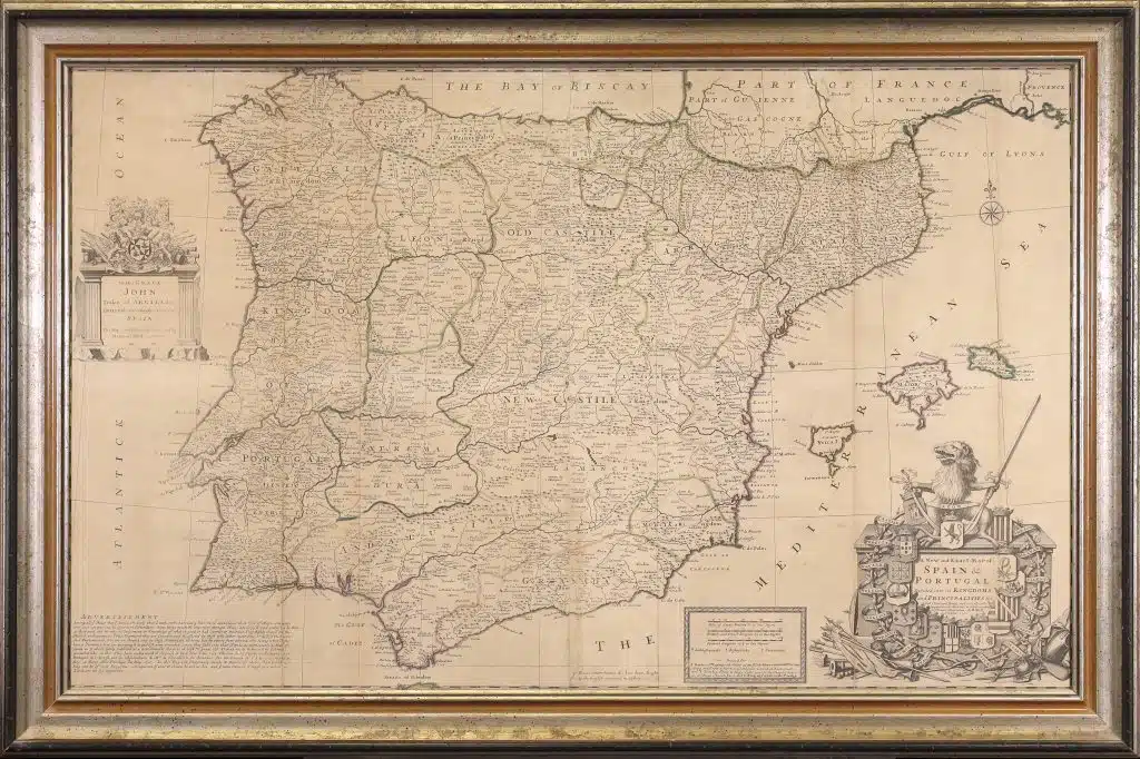
“A New and Exact Map of Spain & Portugal, Divided into it’s Kingdoms and Principalities &C with Ye Principal Roads and Considerable Improvements”; first published in London in 1711.

Herman Moll sketched by William Stukeley, April 1723
Herman Moll was a British cartographer, born sometime in the mid 17th century in Germany. Records of his life are relatively scattered, but by the late 1680s, Moll was running his own map store in central London.
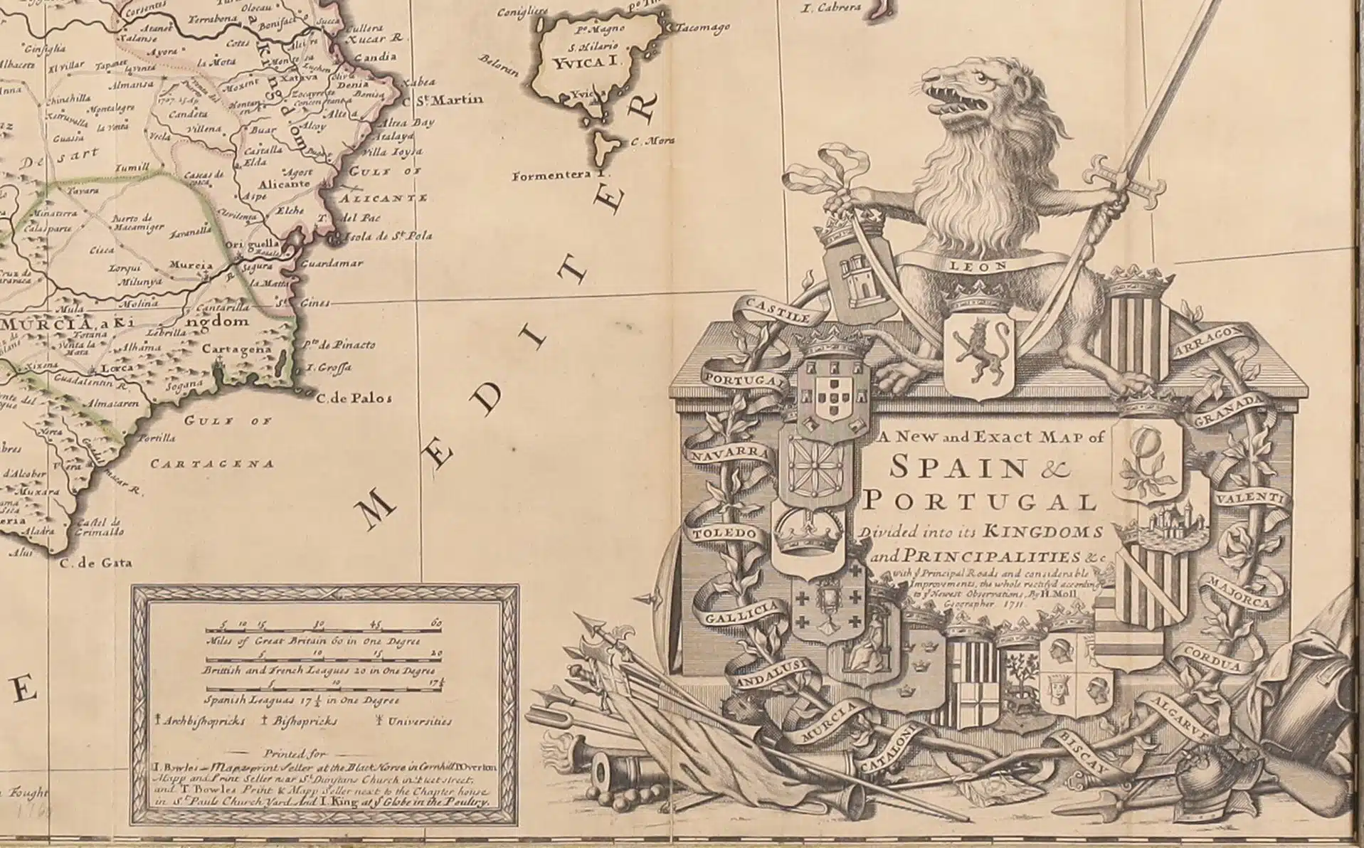
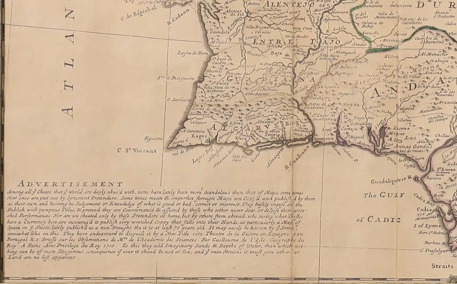
The unique and contentious advertisement included speaks to the competitive nature of map publishing during this period. Moll criticizes his contemporaries for their inaccurate, copied, or deceitfully outdated maps, casting himself as an arbiter of geographical truth. The accusation that others’ maps might even pose a hazard at sea lends gravity to his assertions and highlights the seriousness with which he viewed his own work’s reliability.
Abraham Ortelius
Dutch [1527-1598]

”Cambriae Typus Auctore Humfredo Lhuydo”, 1603
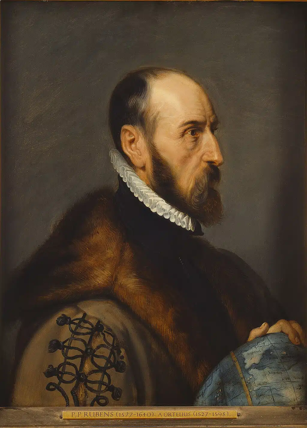
Abraham Ortelius by Peter Paul Rubens
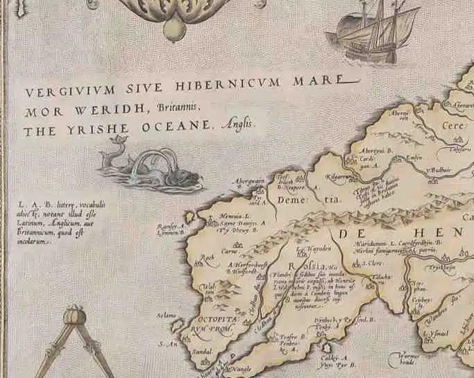
Notable for its topographical details, noting forests and cities, and even the coast of Ireland, Ortelius’ map also includes a charming depiction of a sea monster off the coast.
Ortelius started his map-making career around 1547, and worked with other notable cartographer, Gerardus Mercator. He is often regarded as one of the founders of modern cartography.
Ortelius compiled and standardized maps from various sources into a cohesive collection, revolutionizing geographic knowledge in the 16th century. He was also among the first to suggest that the continents might have once been joined, anticipating the theory of continental drift. He was a prominent figure of the Age of Exploration and a close associate of notable scholars and mapmakers of his time. Ortelius died in Antwerp in 1598.
Willem Blaeu
Dutch [1571-1638]

Valesium Ducatus, Valois
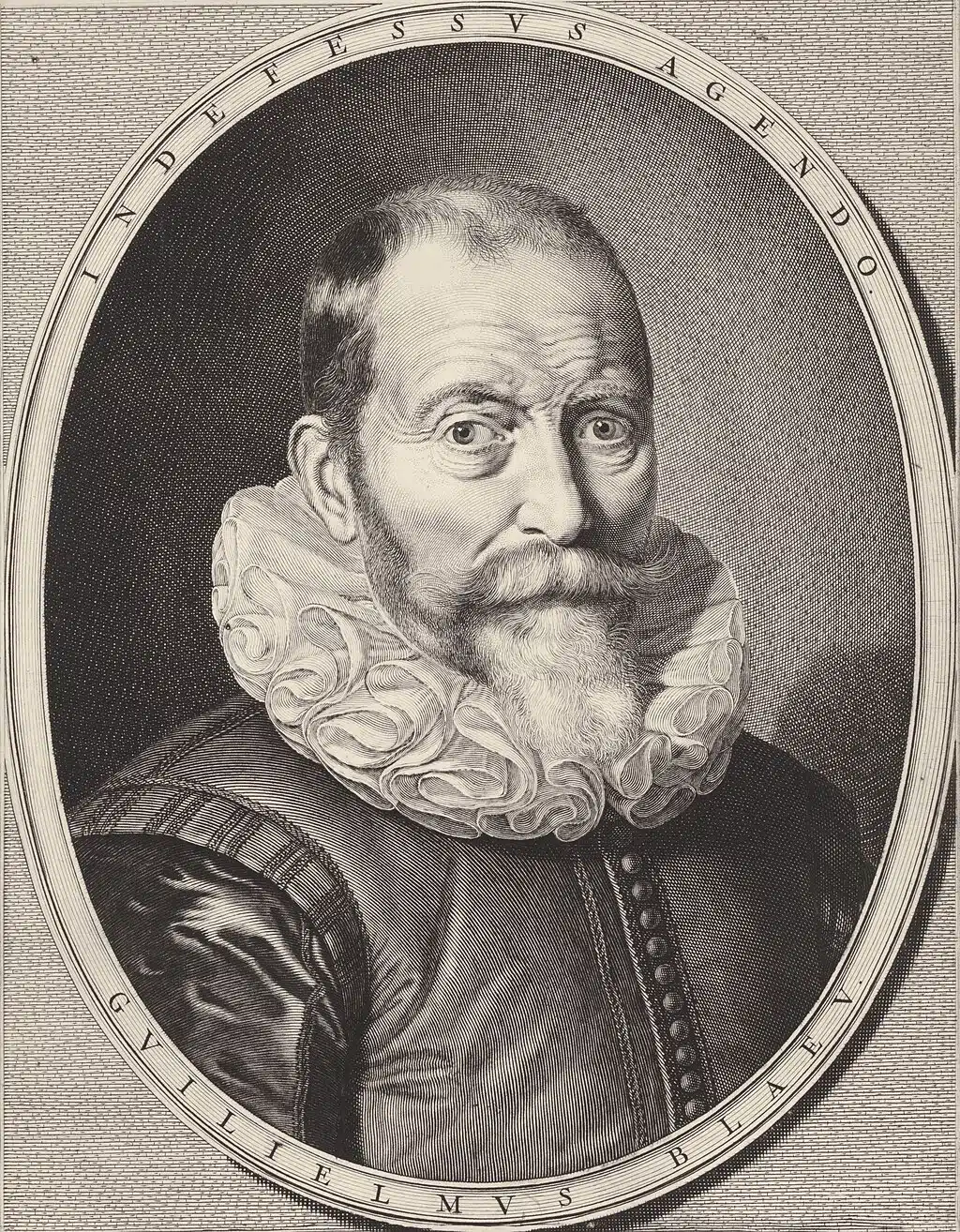
Willem Janszoon Blaeu by Jeremias Falck
Born in Alkmaar, Netherlands, Blaeu studied mathematics and astronomy under the famous Danish astronomer Tycho Brahe, which deeply influenced his scientific and cartographic work.
Blaeu founded a publishing company in Amsterdam that became one of the most prestigious mapmaking firms of the 17th century. His maps were known for their exceptional accuracy, artistic detail, and elaborate decoration. In 1630, he was appointed the official cartographer of the Dutch East India Company, a role that gave him access to valuable geographical information.
One of his most significant achievements was the Atlas Novus, a richly illustrated world atlas that laid the foundation for later multi-volume atlases published by his son, Joan Blaeu. Willem Blaeu’s work helped shape Europe’s geographic understanding of the world and set high standards for mapmaking that endured long after his death in 1638.
Valesium Ducatus. Valois outlines the area found northwest of Paris.
